Articles / LORQAI
The Rivers That Cities Forgot to Mention
Why cities bury rivers underground, how the water keeps moving, and what happens when somebody decides to let it out again.
Beneath busy streets, forgotten rivers continue to flow through tunnels and culverts. An unusual journey into the hidden waterways that helped shape our cities.
By LORQAI
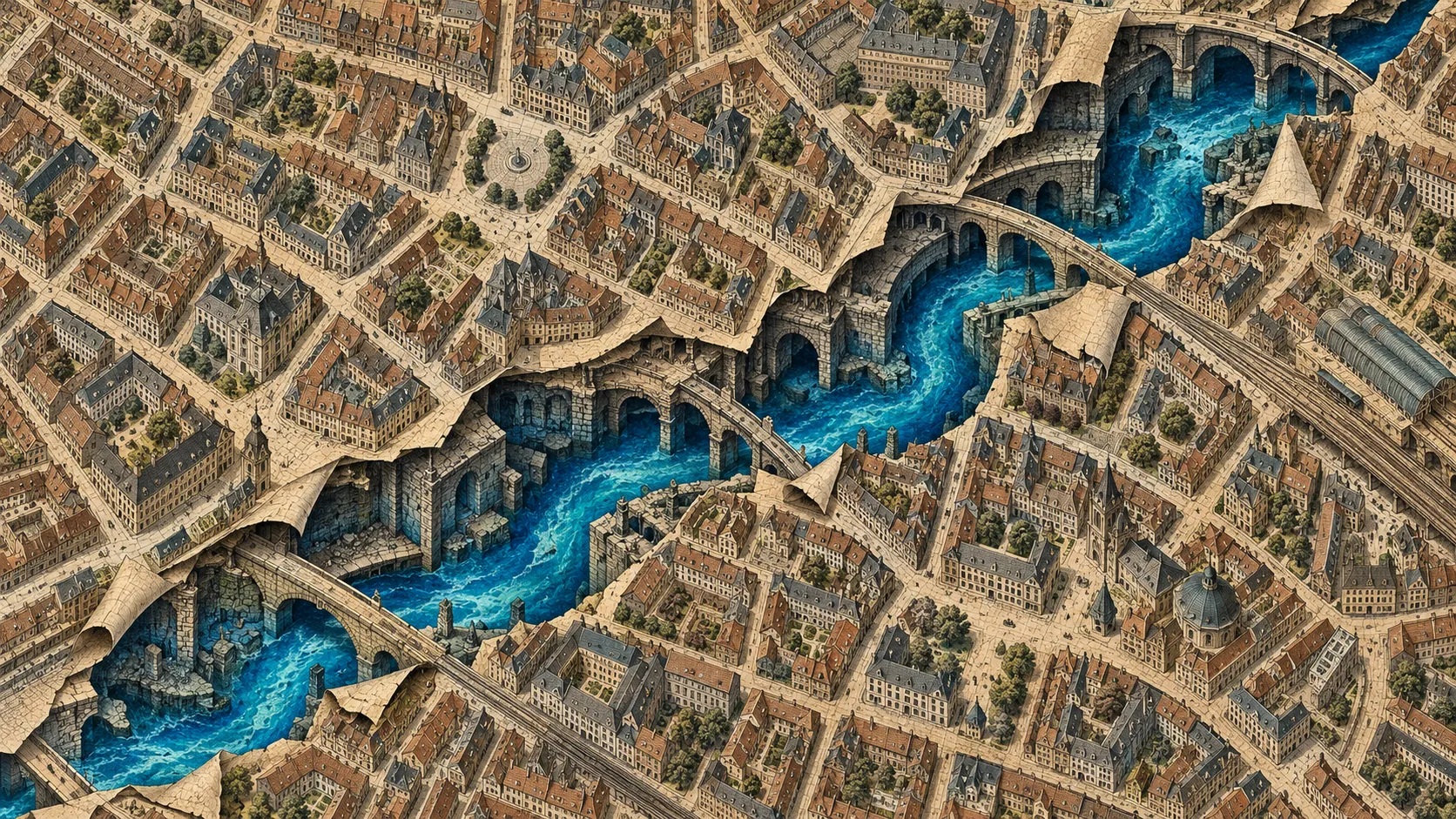
The Vanishing Act
To make a river disappear, you don't necessarily need to drain it.
You need bricks, engineers, a growing city and a sufficiently persuasive reason to put something else on top.
A road will do. A railway is another possibility. If the river has become particularly unpleasant, the promise of removing its smell may convince people who would otherwise object to having a waterway turned into a tunnel.
Then comes the paperwork. The new street receives a name. Buildings acquire addresses. The underground channel becomes part of the drainage network, to be inspected by people wearing practical boots and carrying equipment that nobody wants to borrow.
A generation passes.
The river stops appearing on ordinary maps. People meet for coffee above it. Deliveries arrive. Someone complains about the price of parking. A child drops an ice cream on the pavement. Life continues with all the confidence of a city that believes it knows what lies beneath its feet.
The water continues too.
This is the curious history of many urban streams. They weren't necessarily diverted into distant lakes or emptied into some enormous underground reservoir. They were enclosed, redirected, incorporated into drainage systems, sometimes thoroughly polluted, and gradually forgotten by the people living above them.
London has several famous examples. Other cities have their own. Some of these hidden waterways have recently attracted a new kind of attention, as engineers and planners investigate whether sections could be brought back into daylight.
Which creates a rather unusual situation: a city may spend generations burying a river, then employ another generation of specialists to work out how to see it again.
A Very Useful Nuisance
Before a river becomes an obstacle to urban development, it is often one of the reasons a settlement develops in the first place.
Running water is useful. It can support transport, manufacturing and everyday needs. Smaller streams can shape paths and property boundaries. Water-powered machinery can make a particular valley valuable for work that would be difficult elsewhere.
But rivers are inconvenient colleagues.
They take routes of their own choosing. They occupy land that might otherwise accommodate buildings. They rise and fall with rainfall. They deposit sediment. They refuse to make sharp right-angle turns merely because a property developer has purchased an unusually rectangular plot.
A growing city begins asking questions that a small settlement rarely needs to consider.
How do you build a road across this stream? How do you stop muddy water spreading across a busy thoroughfare? What happens when more houses, workshops and streets occupy the banks? And what should be done when the water that once served the settlement begins receiving its waste?
The answers have varied across places and centuries. Bridges can carry traffic over streams. Channels can direct water along engineered routes. Banks can be strengthened. Some waterways are enclosed inside culverts, the passages that carry water beneath roads and other structures.
A culvert sounds modest. The word has the personality of a document-storage cabinet. Depending on the site, however, it can be a substantial engineered structure through which a stream continues flowing beneath an entire district.
From above, the arrangement seems remarkably efficient.
The city gains usable surface space. The crossing becomes easier. The water is no longer an obvious interruption to the street.
From below, the stream has acquired a ceiling.
This distinction matters. Covering a river can remove it from the urban view without removing the water, its drainage area or the need to manage its flow. The water still has to travel somewhere, particularly after heavy rain. The structure carrying it must be large enough, maintained properly and understood by the people responsible for the infrastructure.
There is also an ecological difference between an open stream and a dark enclosed channel. Light, vegetation, streambed conditions and connections with surrounding habitats change when a watercourse is buried.
The engineering solution that makes sense on a street plan does not leave the waterway untouched. It changes the kind of place the water is allowed to be.
London Had a River Problem
The River Fleet once mattered greatly to London.
It flowed from the northern hills toward the Thames, passing through a landscape that supported settlement, trade and industry. Its lower reaches were once navigable by vessels. Over time, mills, workshops and other businesses operated along its valley.
Today, many people are more familiar with the name Fleet Street than with the waterway behind it.
The change did not happen in one grand ceremony. There was no official moment when someone declared the river obsolete, collected its belongings and asked it to surrender its keys.
It was a gradual and rather unpleasant transformation.
As London grew, the Fleet became a convenient destination for waste. The waterway accumulated rubbish and sewage. Industrial activity added to the pollution. What had been useful water increasingly became an open drainage problem in a crowded city.
The London Museum documents complaints about the river's smell going back centuries. By the time the lower Fleet was widely known as Fleet Ditch, the location had acquired a reputation that was not especially helpful to anyone hoping to market riverside accommodation.
The response involved covering and enclosing sections of the waterway. Later infrastructure development incorporated parts of its course into London's sewer system. The river that had helped shape the city was gradually pushed out of ordinary sight.
The Fleet wasn't alone.
The Walbrook, another London watercourse, was important to Roman and medieval life. It supported activity in the early city and helped shape its geography. According to the London Museum, parts were covered during the fifteenth century, and the watercourse had disappeared from the surface by around 1600.
Its old course survives in the geography of the city and in its name. Beneath modern streets, the story is more complicated than a picturesque river running untouched through an ancient stone tunnel. Centuries of drainage, construction and sewage engineering have altered these waterways considerably.
A lost river is not necessarily a preserved river.
That is an important correction to the romantic image of London's underground world. The hidden waterways aren't all secret crystal-clear streams waiting patiently beneath medieval arches. Some are part of working sewer infrastructure. Others have been diverted, enclosed or altered so extensively that tracing their original character requires historical records as well as modern engineering plans.
Still, the names remain wonderfully suggestive.
Fleet. Walbrook. Tyburn. Westbourne.
Read them without their surrounding streets, offices and traffic, and they sound like places from an older map.
In a sense, they are.
What the Pipe Cannot Erase
Imagine a city planner presenting a completed road project.
The old stream has been put underground. The surface is paved. Traffic moves smoothly. The troublesome crossing has disappeared. The project is considered finished.
Meanwhile, the water continues to obey the much older arrangement of the landscape.
Rain falls over an area. Some of it runs downhill. Some enters the ground. Channels carry water toward lower elevations. In urban areas, roofs, roads and other hard surfaces alter how water moves, often directing runoff into drains and engineered waterways.
A culvert becomes part of that network.
It can be designed to carry the expected flows, but it remains a physical structure with limits. Sediment and debris may require attention. Blockages can cause problems. Heavy rainfall can challenge drainage systems, especially when conditions exceed what a particular system was designed to handle.
The fact that a river is hidden does not make it irrelevant to flooding or infrastructure management.
Nor does an underground channel automatically provide the same environment as an open stream. Removing daylight and natural streamside connections changes the conditions available to aquatic organisms. Researchers studying buried streams have examined differences in habitat, water chemistry and biological communities between enclosed and exposed reaches.
There is nothing mystical about this. A tunnel has a roof. Sunlight cannot reach much of its interior. Its surfaces and water movement may differ from those of a natural channel. The surrounding city has also altered the water entering it.
What makes the situation interesting is the contrast between two ways of understanding a city.
On a street map, the most important features tend to be things people can use directly: roads, stations, buildings, bridges, squares, parks. The map tells you how to get from one place to another.
A drainage map tells a different story.
Its channels may cross beneath the routes you follow. It includes structures whose existence matters enormously to engineers and almost not at all to the person buying a sandwich upstairs.
A historical map adds another layer, sometimes showing streams and valleys that preceded the modern streets.
The three maps are not competing descriptions of the same city. They answer different questions.
But put them beside one another and a familiar neighborhood can become unexpectedly strange.
A road may follow a former valley. A place name may preserve a watercourse's identity. A modern drainage route may echo an older channel, although the two should not be assumed to coincide exactly.
The city is no longer a flat arrangement of streets and buildings. It becomes a collection of decisions stacked over a landscape that existed before any of them.
And somewhere in that collection, the river is still going about its business.
The Day Someone Suggests Digging It Up
Eventually, in some cities, a different question is asked.
What if we uncovered part of the river?
The process is commonly called daylighting. It involves bringing a previously buried or enclosed waterway back to the surface, sometimes while restoring aspects of its channel and surrounding habitat.
The expression sounds wonderfully casual.
You might daylight a room by opening the curtains. Daylighting a river is rather more involved.
There may be roads, utilities, foundations or other structures above the buried channel. The water may be connected to a sewer network. The surrounding land may belong to different owners. The original riverbed might be inaccessible, heavily modified or impractical to recreate.
Then there are the costs.
A buried stream cannot simply be pulled out of the ground like a cable. Engineers need to understand its flow and existing infrastructure. Designers must decide where the exposed water will travel. Flooding, water quality, public access, maintenance and habitat are all relevant considerations.
Sometimes the answer is that reopening a particular stretch is not practical. Sometimes an altered route offers a feasible alternative. Sometimes only a short section can be restored.
But it can happen.
In Yonkers, New York, part of the Saw Mill River had been enclosed beneath the downtown area. The city later undertook a project to expose sections of the waterway again.
The work involved more than excavating a channel. Engineering plans addressed drainage, the relationship between freshwater and tidal influence, pedestrian connections, landscaping and the infrastructure surrounding the reopened river.
The result provided a newly visible watercourse within an urban public space.
It is an appealing reversal. A previous generation had regarded the covered river as a way to make room for the city. A later generation identified potential value in giving some of that room back to the water.
Neither decision happened outside its historical circumstances.
The people who enclosed urban streams were often dealing with serious sanitation, flooding and space problems using the knowledge and infrastructure available to them. It is tempting to imagine that uncovering every buried stream would automatically produce a healthier and more attractive city, but modern restoration is constrained by its own practical realities.
Research into daylighting projects identifies site conditions, infrastructure, costs and social considerations as important factors. Benefits vary. A project that works well in one location cannot be reproduced everywhere simply because the photographs look attractive.
And the past is not reversible in any literal sense.
Opening an engineered channel does not restore the exact stream that existed before the surrounding city was built. Its watershed may have changed. Its original floodplain may now contain important infrastructure. The ecology may require extensive restoration, and some features may never return.
What can be created is a new relationship between the water and the city.
That is less romantic than turning the clock back several centuries.
It is also considerably more useful.
An Unusual Piece of Urban Archaeology
Most archaeology begins with the assumption that something from the past has been left behind.
A buried river complicates the arrangement.
The route may be historical, but the water is contemporary. It is still participating in the daily operation of the landscape. The remains of an old channel may exist alongside modern drainage structures, altered banks and utility tunnels.
The subject of the investigation is therefore both old and current.
Cities have many such overlapping identities. A disused industrial building becomes a theater. A railway viaduct acquires shops beneath its arches. A former market keeps its name after its original trade has vanished. These places offer familiar examples of urban history remaining visible while its function changes.
A hidden river is stranger because its function has not entirely stopped.
Water continues moving, although its route and conditions may be very different from those of the original stream.
This is why stories about lost rivers can alter the experience of an ordinary walk.
A street sign becomes a historical clue. A dip in the terrain becomes something to investigate rather than ignore. A curious alignment of roads suggests that the modern city may have been built around an older obstacle.
Such clues are not proof by themselves. Street names can have several origins, and a valley does not establish the precise location of a buried stream. Historical maps, local archives and drainage records are needed to confirm what once flowed where.
But the questions become more interesting.
What occupied this corner before the road? Why does the street curve here? Was there once a bridge? Did the stream influence the growth of the neighborhood, or was its route later changed to accommodate the buildings?
One ordinary location can turn into several overlapping landscapes, each belonging to a different period of the city's history.
You do not need to believe in secret underground kingdoms to find that remarkable.
A city has enough hidden complexity without inventing any.
The Street Above
There is an ordinary practical detail that rarely appears in romantic accounts of underground rivers.
Someone has to maintain the culvert.
The structure needs inspection. Its condition matters. Engineers must consider damage, obstructions, erosion and the behavior of water during heavy rainfall.
The stream may be absent from tourist maps, but it cannot simply be forgotten by the people responsible for keeping the city functioning.
Perhaps that is the most accurate meaning of a lost river. It is often lost to everyday attention rather than to every institution that manages it.
Meanwhile, aboveground, the street continues.
The traffic lights change. The pavement is repaired. Shops open and close. A building receives a new tenant. Somebody complains that the roadworks have lasted far longer than promised.
Beneath it all, a channel carries water through a route whose history may be older than the surrounding blocks.
In another city, perhaps, an excavator is beginning the opposite job. A section of pavement is removed. Engineers examine a buried structure. A new open channel is prepared, and a piece of water that had been treated as infrastructure becomes part of the visible landscape again.
The two scenes can exist at the same time, in different places, without either representing a universal answer.
Cities need streets. They need drainage. They also have reasons to protect and, where practical, restore their waterways.
The interesting question is not whether every buried stream should be uncovered. It is whether the next decision about the river will recognize everything the previous decision changed.
There is an appealing irony in the official records of such projects.
For years, a river may appear mainly as a drainage asset, a maintenance obligation, a culvert running beneath a road.
Then a restoration proposal gives it another description.
Watercourse.
Habitat.
Public space.
River.
After all the engineering, paperwork and expensive machinery, the oldest word on the list has become useful again.