Articles / LORQAI
The River That Disappears Beneath a Mountain
On Palawan, a river flows beneath a limestone mountain and emerges at the sea, where tides bring saltwater into the cave. Discover the geology and ecology of Puerto Princesa’s remarkable underground river.
Introduction
In the Philippines, a river vanishes into limestone, travels through enormous chambers beneath a mountain, and reaches the sea. But the ocean does something unexpected: it reaches back.
There is a place on the Philippine island of Palawan where a river appears to make a remarkable decision.
Instead of continuing across the landscape beneath the open sky, it disappears into a mountain.
Not into a small opening where the water quietly drains away.
Into an enormous limestone cave.
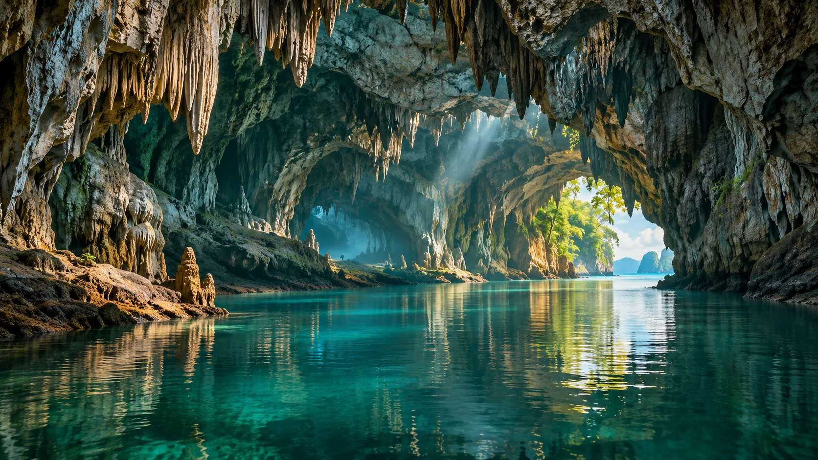
Beyond the entrance, the river continues through darkness, beneath rock formations that have taken immense stretches of geological time to develop.
And eventually, the water reaches the sea.
This is the Puerto Princesa Underground River, one of the most remarkable features of the Puerto-Princesa Subterranean River National Park.
At first glance, its existence raises an obvious question.
How can a river flow through a mountain?
But the more interesting question comes later.
What happens when the ocean begins pushing water back into the cave?
The River That Refuses to Stay on the Surface
Most rivers are easy to imagine.
Rain falls onto hills and mountains. Water collects in streams. Streams join to form larger channels. Gravity carries the water downhill, usually toward a lake or an ocean.
We can follow much of this journey across the land.
But not every river completes its journey in daylight.
On Palawan, the Cabayugan River drains part of the landscape surrounding the St. Paul limestone range.
It flows through a tropical environment of forests, cultivated areas, and limestone mountains before entering an underground passage.
The river does not end at that point.
Its route simply continues out of sight.
According to UNESCO, the underground river system extends approximately 8.2 kilometers before reaching the sea.
For visitors entering from its coastal opening, the journey begins in the opposite direction: from daylight into the mountain.
The cave entrance is surrounded by steep limestone walls and vegetation.
Then the natural light begins to disappear.
Inside, the visible landscape changes from trees and cliffs to rock ceilings, mineral formations, underground water, and chambers large enough to make the human presence feel unexpectedly small.
The mountain is not solid in the way it might appear from outside.
It contains an intricate system of spaces shaped by water.
And to understand how those spaces formed, we need to understand what limestone allows water to do.
How Water Finds a Way Through Stone
Limestone is a sedimentary rock composed mainly of calcium carbonate.
Much limestone forms through the accumulation of carbonate material in ancient marine environments, including the remains of organisms that lived in the sea.
Over time, those deposits can become thick sequences of rock.
The limestone formation associated with Puerto Princesa is estimated by the park's official geological information to be approximately 20 million years old.
But that does not mean the underground river itself has existed in its present form for 20 million years.
The age of the rock and the age of the passages carved through it are different questions.
Once limestone is exposed to circulating water, something important can happen.
Rainwater absorbs carbon dioxide from the atmosphere and soil, becoming slightly acidic. As that water enters fractures and openings in limestone, it can gradually dissolve calcium carbonate.
The process is called chemical weathering or dissolution.
At first, water may move through very narrow cracks.
Over long periods, some of those openings widen.
Water follows available pathways through the rock, and erosion can further modify passages where flowing water carries sediment.
Eventually, interconnected underground channels and caves can develop.
The broader geological environment produced by these processes is called karst.
Karst landscapes appear in many parts of the world, sometimes containing sinkholes, disappearing streams, underground drainage networks, and enormous cave systems.
At Puerto Princesa, the St. Paul limestone range provides the geological setting for one of the most impressive examples.
The river did not drill through the mountain in a single dramatic event.
Its underground route developed through geological processes operating across long timescales.
A Hidden World of Stone
The darkness inside the Puerto Princesa cave is not an empty darkness.
The cave contains formations that reveal a different aspect of water's relationship with limestone.
Some water does not travel quickly through an underground channel.
Instead, it moves slowly through rock, emerging as drops from a cave ceiling.
As conditions change, dissolved minerals can be deposited.
Over time, these deposits form structures known as speleothems.
Stalactites grow downward from ceilings.
Stalagmites rise from the cave floor.
Other deposits can create flowstone, columns, and intricate mineral surfaces.
The shapes depend on how water enters the cave, where it moves, and how minerals are deposited.
What makes the Puerto Princesa system especially striking is the scale of its chambers.
UNESCO describes some spaces reaching approximately 120 meters in width and 60 meters in height.
These dimensions are difficult to appreciate from photographs alone.
A chamber tens of meters high can make a small boat seem almost insignificant.
The same water that helped create passages through limestone also contributed, through mineral deposition, to the formations that decorate them.
One process removes rock.
Another places some dissolved material back.
The cave is shaped by both.
The Ocean That Enters the Mountain
There is an additional feature that separates Puerto Princesa from many familiar freshwater cave systems.
Its underground river flows directly into the sea.
And that means the interaction does not travel in only one direction.
Rivers normally carry freshwater downhill toward the ocean.
Ocean tides, however, raise and lower coastal water levels.
At Puerto Princesa, the lower portion of the underground river is affected by those tides.
As sea level changes with the tidal cycle, marine water can influence conditions inside the cave.
UNESCO identifies the lower half of the river as brackish.
Brackish water contains a mixture of fresh and salt water.
It is neither as fresh as an ordinary inland river nor necessarily as salty as the open ocean.
The boundary between marine and freshwater influence is not a permanent line drawn across the cave.
Its position and character can change depending on tidal conditions, freshwater discharge, and the structure of the underground channel.
This is what makes the river so scientifically interesting.
The mountain contains a place where two different water systems interact.
Freshwater travels toward the coast.
The sea exerts its own influence inland.
And the river becomes a living example of the connection between underground drainage and the ocean.
It would be misleading to describe the whole river as flowing backward whenever the tide rises.
The important phenomenon is tidal influence on water levels, circulation, and the freshwater–saltwater environment in the lower cave system.
That distinction makes the real explanation more interesting than the simple image of an ocean reversing an entire river.
A Mountain That Is Part of the Sea
The Puerto Princesa Underground River reveals something that can be easy to overlook when looking at a coastal mountain.
The mountain is not isolated from the ocean.
Its surface collects rainfall.
Its rock contains fractures and passages.
Its underground drainage routes carry water toward the coast.
And the sea influences the lower reaches of that drainage network.
The cave is therefore part of a larger connected system.
Changes above ground can affect what happens underground.
If water flowing through the landscape carries sediment or pollutants, those materials may enter underground channels.
In karst environments, water can sometimes travel through openings more directly than it would through thick layers of soil.
This makes the condition of the surrounding land important for protecting subterranean water systems.
At Puerto Princesa, conserving the river is inseparable from conserving the land around it.
The cave cannot be treated simply as an isolated tourist attraction.
Its existence depends on a landscape that extends from the mountains to the sea.
Life Above and Below the Limestone
The national park is remarkable not only for its geology.
UNESCO recognizes its importance as a mountain-to-sea ecosystem with significant biodiversity.
The protected landscape includes several distinct forest environments, from lowland tropical rainforest and limestone forest to mangroves and coastal habitats.
This variety matters because different environments support different communities of organisms.
Some species depend on forest cover.
Others occupy rivers, coastal areas, or caves.
Inside the cave system, bats and swiftlets are among its notable inhabitants.
The cave is not simply a dark tunnel through which water happens to pass.
It is part of a broader ecological network.
Organisms living within caves can depend on nutrients brought in by water, animals, and other connections with the outside environment.
Meanwhile, the forests above the cave influence the landscape through which rainwater travels.
The river connects environments that, from a human perspective, may appear separate.
Mountain slopes, forest floors, underground rock passages, estuarine water, and the sea all belong to the same larger story.
That is one reason why protecting the cave alone would not be enough.
Why UNESCO Recognized Puerto Princesa
In 1999, Puerto-Princesa Subterranean River National Park was inscribed on the UNESCO World Heritage List.
Its recognition reflects two particularly important qualities.
First, it contains a spectacular limestone karst landscape and an underground river that connects directly with the sea, including the unusual tidal influence within its lower reaches.
Second, it protects habitats of outstanding importance for biodiversity.
The site therefore represents both geological and ecological heritage.
This distinction is important.
The river is not recognized merely because visitors can travel into a dramatic cave.
Its value also lies in the natural processes that created it and the ecosystems connected to it.
The national park is managed by the City Government of Puerto Princesa, with a system of conservation and visitor management intended to balance protection with public access.
The park's official tourism information describes paddle-boat journeys that allow visitors to experience part of the cave.
Although the underground river extends for approximately 8.2 kilometers, the ordinary visitor experience does not cover its entire length.
The publicly accessible experience is only part of a much larger natural system.
And that is probably appropriate.
Some of the most important things about the cave cannot be understood simply by traveling farther into it.
They must be understood by studying what connects it to the landscape outside.
What Would Happen Without the Mountain?
Imagine, for a moment, that the limestone mountain did not exist.
Rainfall would still collect on the surrounding land.
Streams would still move downhill.
Water would still seek a route toward the coast.
But without the particular geology of the St. Paul limestone range, the drainage network would be different.
The underground passages, mineral formations, and distinctive connection between the river and the sea would not exist in their present form.
This reveals an important principle of geology.
Water does not create the same landscape everywhere.
Its effects depend on the material through which it moves.
In some places, rivers cut open valleys through rock.
Elsewhere, they follow fractures beneath the ground.
In limestone, water can dissolve its way into complicated networks of passages.
And near the coast, those passages can become places where freshwater and marine water meet.
The Puerto Princesa Underground River is not simply an ordinary river concealed beneath a mountain.
It is the result of a particular geological history and a particular relationship between rock, water, and the sea.
The River That Never Really Disappears
It is tempting to describe Puerto Princesa as a place where a river vanishes.
From above ground, that is exactly how it appears.
A flowing river approaches a mountain.
Then it is gone.
But the river has not vanished at all.
It is continuing its journey through a landscape that happens to be hidden from view.
Along the way, it reveals the chemistry of limestone, the persistence of moving water, the formation of caves, and the influence of ocean tides far beyond the open shoreline.
The most remarkable part of the story may be that the mountain does not separate the river from the sea.
It connects them.
A river enters the darkness.
The ocean reaches into the cave.
And somewhere beneath millions of years of limestone, two worlds meet.
The water was never lost.
We simply could not see where it went.
Listen & explore
- UNESCO World Heritage Centre — Puerto-Princesa Subterranean River National Park (external platform)
- Puerto Princesa Underground River — Geology (external platform)
- UNEP-WCMC — World Heritage Datasheet (external platform)
- UNESCO — 1999 World Heritage Committee Decision (external platform)
- Puerto Princesa Underground River — Tourism (external platform)